Today it was another road trip!
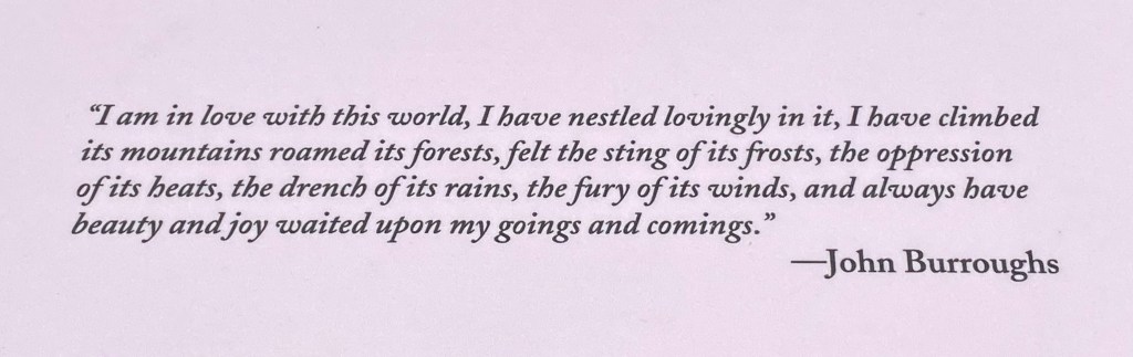
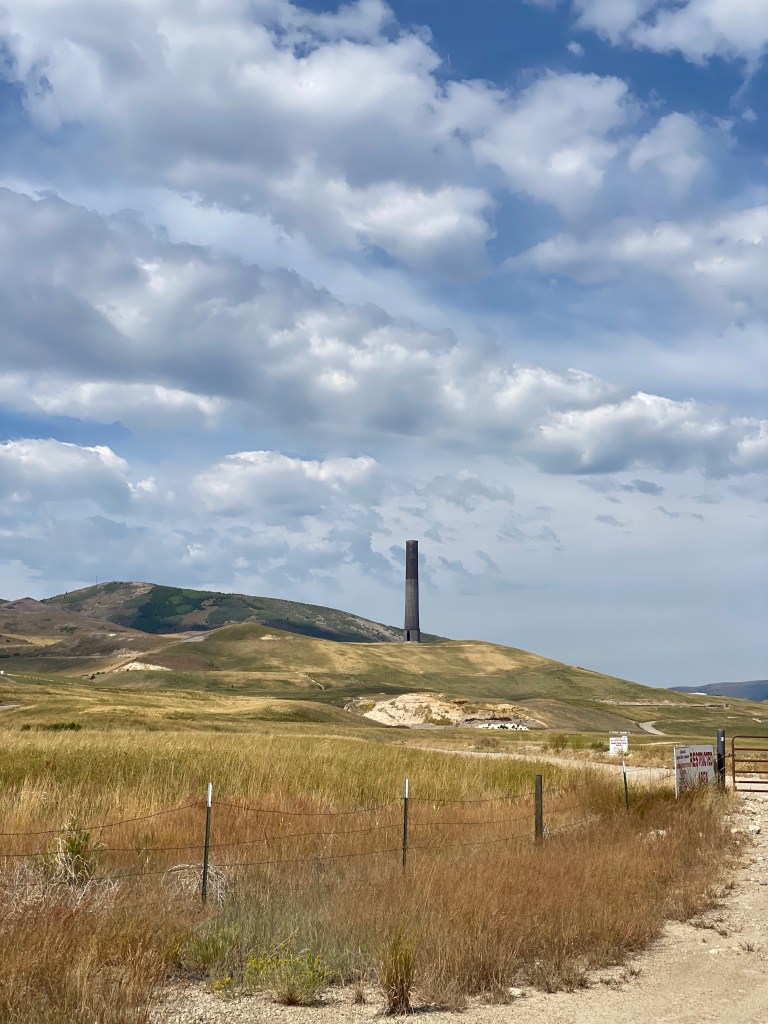
This adventure started in Anaconda, Montana. Anaconda has a rich and varied history so click on the link to learn more. It is an old town and there are many cool buildings. One interesting thing there is the historic Anaconda Smelter Stack. I thought you could go up to it but apparently not – at least not that I could see. I did stop and snag a few pictures though:
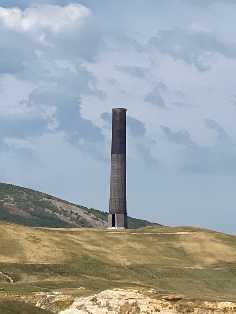
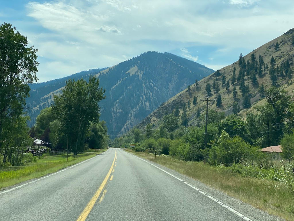
I left Anaconda and took MT-43 – a two-lane road the led me to the southwest corner of the state – an area I had never been to. It was absolutely one of the top drives I have ever taken. Stunning scenery made of the stuff that make the blue highways the best way to travel to really see the country. Interstates get you there in generic fashion but it’s certainly faster. Finding the balance is the key if time is precious, but if you are in no hurry the backroads should be your first choice.
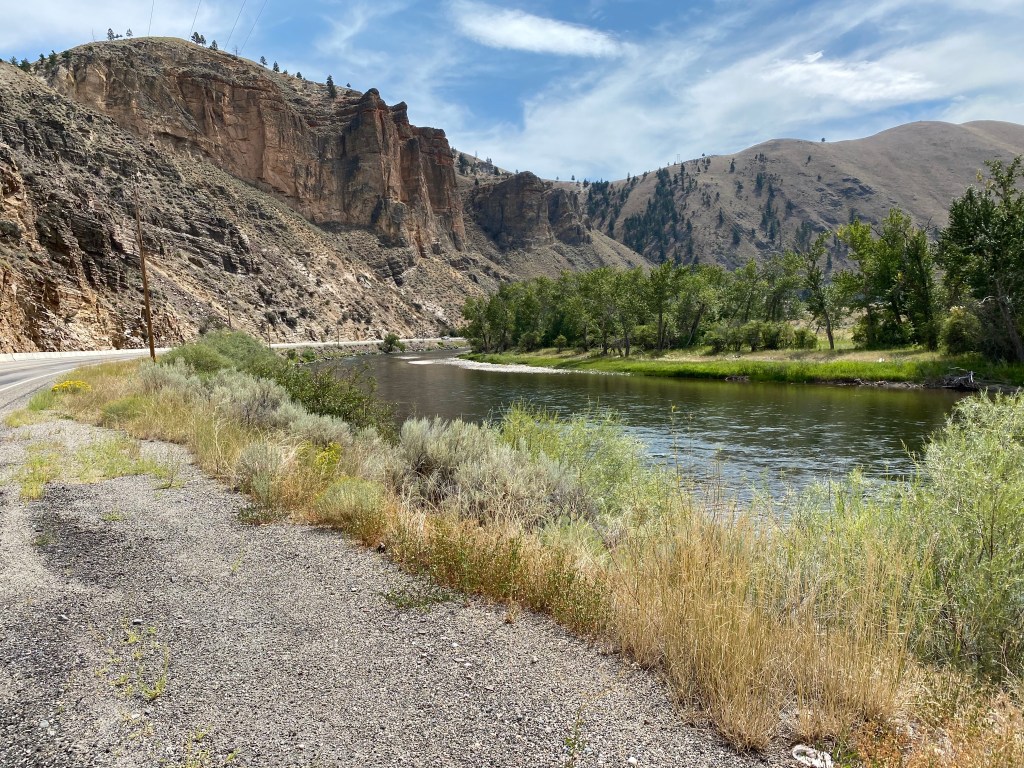
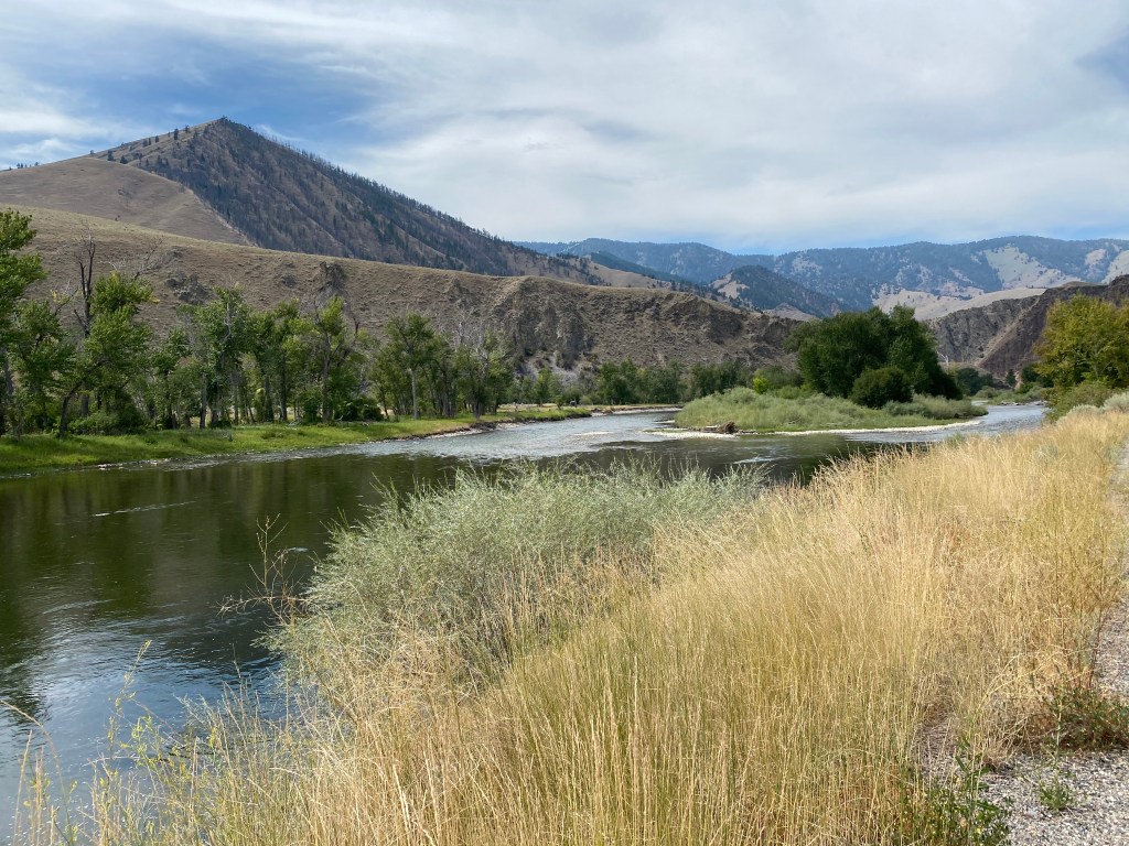
As you can see, the scenery was incredible:

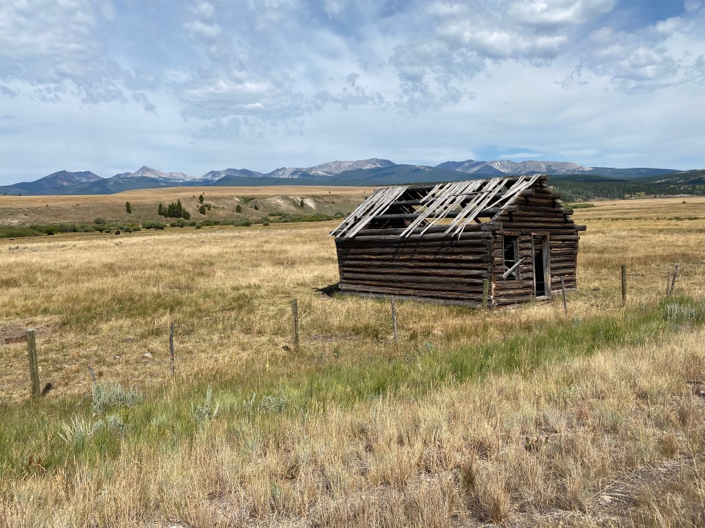
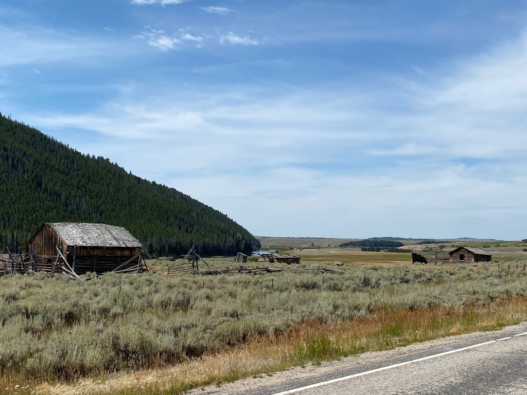
Mountains, grasslands, ranches, rivers, forests, historic sites…the terrain ran the the gamut along this road. I saw some incredible four-wheeling opportunities and it made me think back of all the fun we had and the trips we made off-roading in Big Red back in the forests of Colorado.
I can see taking this road again, especially since I found…
It was here I had a choice to make as far as getting back to the house, but me being me I decided to take the long way. I was pretty close (about 10 miles) to a National Park site I had never been to and wanted to see.
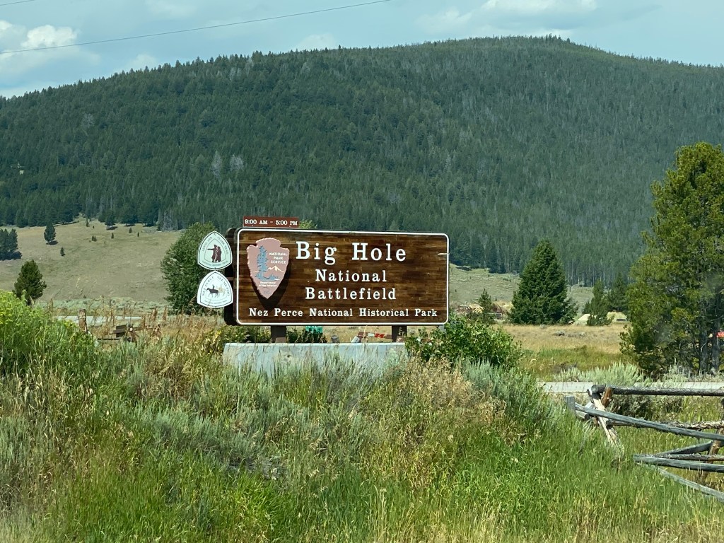
I have a National Parks Passport book so I thought I would see how busy it was and if it wasn’t I would put on the mask and gloves and go inside real quick to get my book stamped. It wasn’t to be since the visitor center was closed. At least the site was open and I could look around.
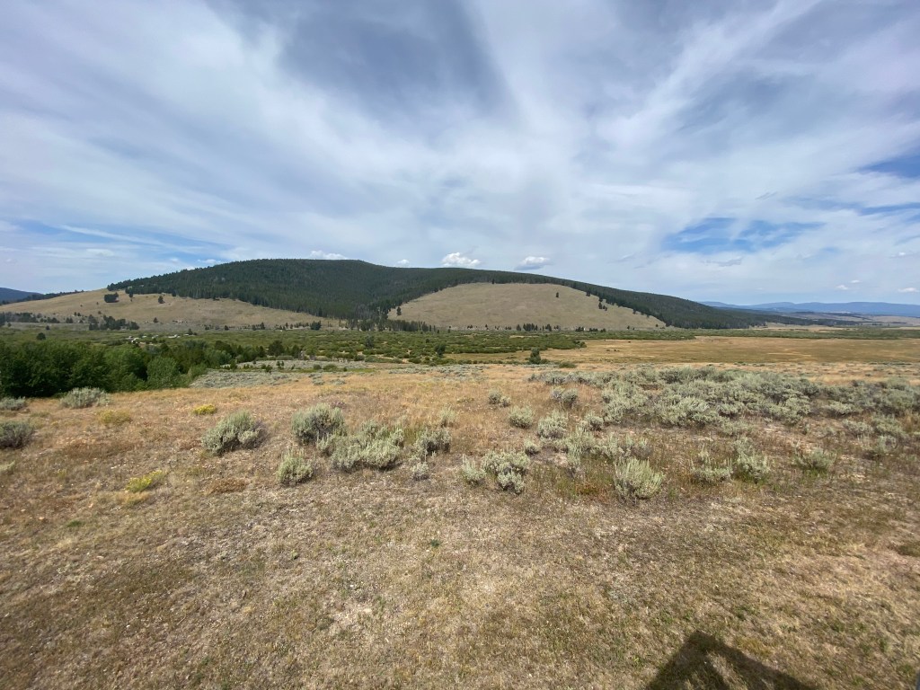
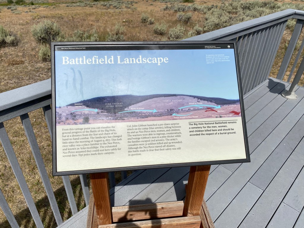
I did not get out and walk around much. I knew it was going to be several hours on the road on this journey so I really did not have much time to spare. Not to mention bear activity was posted and I have no bear spray. I did drive down below to where the parking area is to hike around on the battlefield. I don’t like to rush like this and want to come back again and see this area at a more leisurely pace. Along with this site there are many more tied in with it around the area as well as a rich history with the Lewis and Clark Expeditions. I am interested in historical things/history and this whole trip ended up being more history than I imagined.
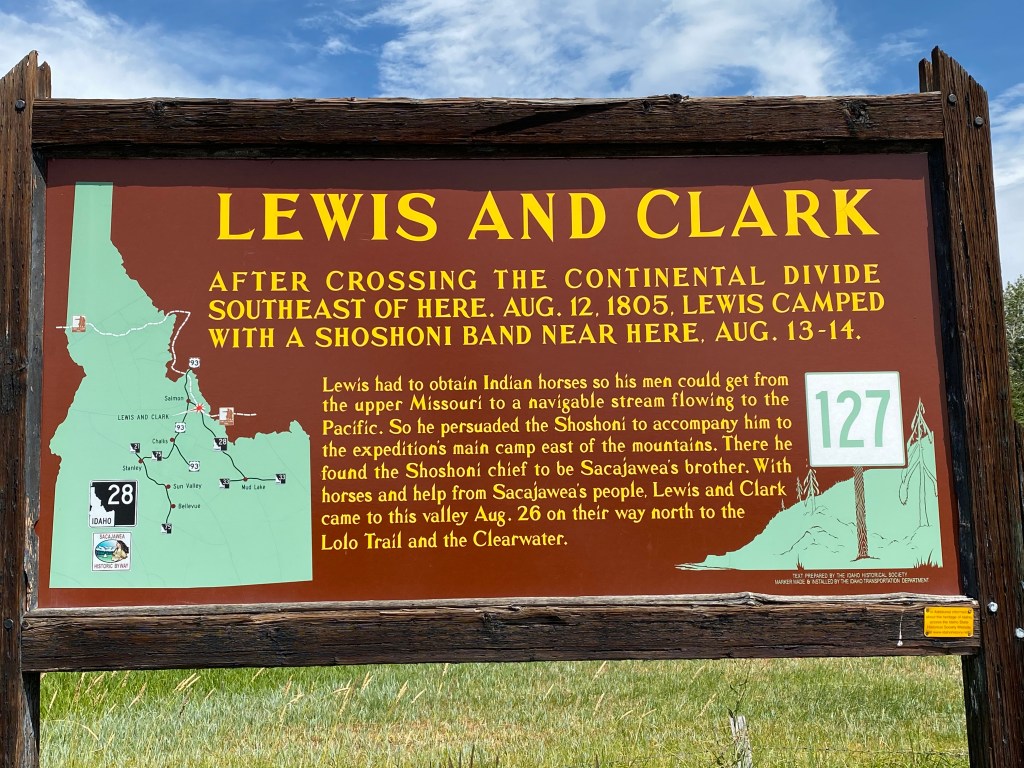
I decided to continue on over to Idaho on MT-43, up Chief Joseph Pass to US 93 then south toward Salmon, Idaho. I have been on this highway before back in 2012 on one of my many road trips, that particular one with my friend Rich. Some of it looked familiar (an uncanny knack I have for remembering places from long ago that I have been to…).
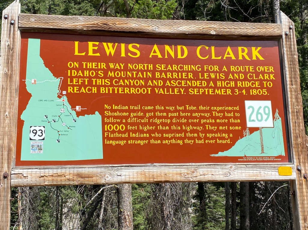
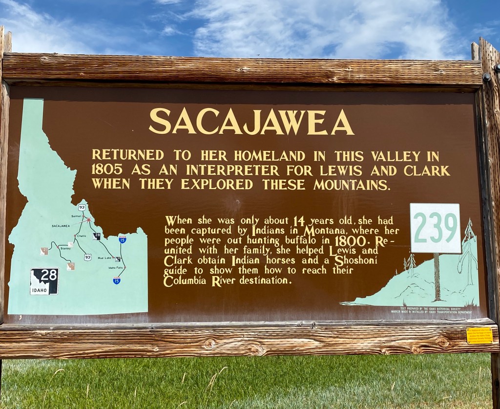
I ventured on down to Salmon, ID…birthplace of Sacajawea. The entire trip down 93 from the pass had several signs about the Lewis and Clark Expedition. I did not stop at all of them – some snuck up on me and I was not going to backtrack.
As with many places out West and in the mountainous areas, if you look closely on some of the hillsides you will see what looks like a narrow road. More than likely those were wagon roads that were later converted into being used for railroad tracks. Some can be hiked on and you will see old trestles, rock walls, and tunnels along these trails. I have driven on some that the current roads were laid on top of the old roadbeds. In Colorado I have hiked through some of the old tunnels and crossed old trestles. It is really interesting to do.
I took ID-28 out of Salmon, heading southeast. Just as you leave town there is a visitor center with beautiful grounds dedicated to Sacajawea. I stopped to just drive through and look – too many people for me. Along this road there were many more signs about the expedition.
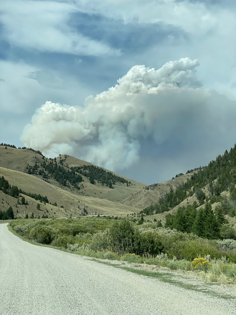
It was along this stretch a big dose of reality hit. No, I did not run out of gas. It was this:

My long way just turned in to a longer way. I was planning on cutting through the forest to start heading back north but the road was closed at Tendoy. This fire was going to make the day longer…several hours longer. This meant driving almost down to Idaho Falls then cutting back north. I was already making a long trip in a day, but what else can you do but roll with it? It was either that or backtrack and I’m retired.
I continued to watch the fire as I ventured on south. When I got to the next turn to go in the forest on ID-29 I took it. No closed signs so that was good news, but I called the Ranger Station just to check. She said the road appeared to be open so I went for it. I really did not think I could get through once I got to the top but it was still open so I went down the other side.
Being in he middle of a closed area when there is a forest fire is pretty damn scary. I did it a few years ago to look for campers and it scared the hell out of me. This time was not as scary but still intimidating since I was driving right under the smoke plume as it was blowing east. As you can see by the pictures I was very close – I was surprised they even had that road opened to be honest.
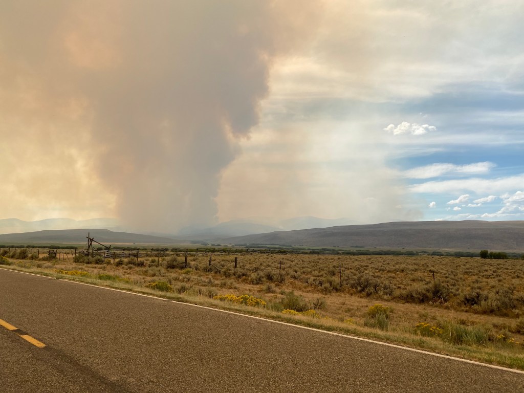
I got through the area and continued on through more beautiful scenery but I think they might have been closing it after I went through. I was heading toward I-15 to go north toward Dillon, then more two-lane adventures and beautiful surroundings heading northeast toward Whitehall.

I ended up driving roughly 470-miles today. Not a lot of driving on a long trip/vacation when you think about it, but it just seems like a lot when you are doing it as a day trip. It is all the same though…and it beats sitting at home!

